

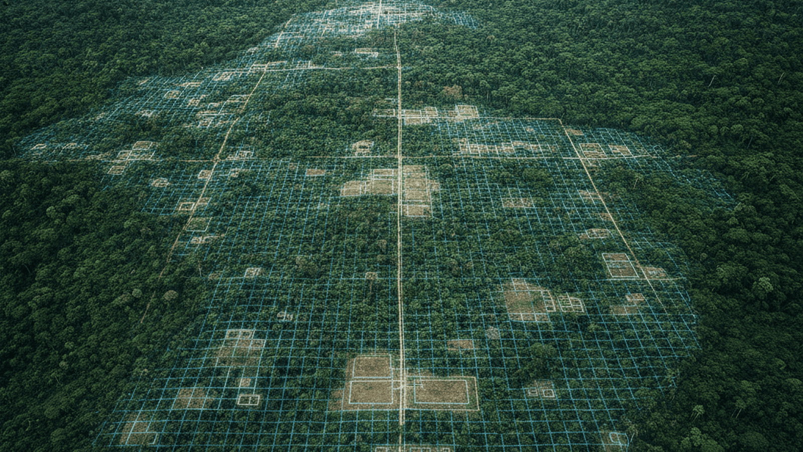
Researchers have utilized AI-driven LiDAR analysis to uncover a massive, 2,500-year-old urban complex in the Ecuadorian Amazon. The discovery reveals a sophisticated network of earthen platforms and roads, suggesting a much higher population density in the pre-Columbian rainforest than previously believed.
TLDR: Scientists used AI and LiDAR technology to map a vast, ancient urban network in Ecuador’s Upano Valley. The findings reveal over 6,000 structures connected by a complex road system, proving that the Amazon hosted large, organized civilizations over two millennia ago.
Archaeologists working in the Upano Valley of eastern Ecuador have announced the discovery of a vast, interconnected network of ancient cities, significantly altering the historical understanding of the Amazon basin. This discovery was made possible through the integration of Light Detection and Ranging (LiDAR) technology and advanced machine learning algorithms. By processing vast amounts of aerial data, researchers identified thousands of earthen mounds and structures that had remained hidden beneath the dense tropical canopy for over two millennia.
The study, led by Professor Stéphen Rostain of the French National Centre for Scientific Research (CNRS), represents the culmination of over twenty years of traditional fieldwork supplemented by modern remote sensing. The AI-driven analysis allowed the team to map an area of approximately 300 square kilometers, revealing a complex urban landscape that flourished between 500 BCE and 600 CE. The scale of the settlement suggests it was home to tens of thousands of people, rivaling the complexity of contemporary Mayan urban systems in Central America.
The identified structures include more than 6,000 raised earthen platforms arranged in geometric patterns around central plazas. These platforms likely served as the foundations for timber dwellings and ceremonial buildings, elevated to protect against the damp forest floor. Connecting these residential hubs is an extensive network of straight roads and paths, some stretching over 10 kilometers in length. The precision of the engineering indicates a highly organized society with sophisticated knowledge of land management and hydraulic systems, including drainage canals designed to handle the region’s heavy rainfall.
The use of artificial intelligence was critical in distinguishing man-made features from the natural topography of the rugged Andean foothills. Traditional LiDAR processing can be labor-intensive, requiring manual identification of anomalies in the terrain. However, the researchers employed neural networks trained to recognize specific geometric signatures associated with pre-Columbian architecture. This automated approach accelerated the mapping process and uncovered smaller, subtle features that might have been overlooked by human observers, such as low-lying agricultural terraces and hidden footpaths.
Field expeditions to the Upano Valley have since confirmed the accuracy of the digital maps through targeted excavations. Ground-truthing efforts revealed ceramic shards, stone tools, and charred organic remains that provide a glimpse into the daily lives of the Kilamope and Upano cultures. These groups practiced intensive agriculture, likely cultivating maize and sweet potatoes on the fertile volcanic soils of the valley. The presence of large-scale defensive ditches also suggests that these urban centers faced periods of conflict or required clear territorial boundaries to manage their growing populations.
This discovery challenges the long-held “myth of the pristine forest,” which characterized the pre-Columbian Amazon as a sparsely populated wilderness. Instead, the Upano Valley findings suggest that the rainforest was a “cultural landscape” shaped by human hands for centuries. The density of the settlements indicates a level of social stratification and labor coordination previously thought impossible for the region. It suggests that the Amazonian peoples were not just nomadic hunter-gatherers but were capable of building enduring, complex urban environments.
The success of the AI-LiDAR methodology in Ecuador provides a blueprint for future archaeological exploration in other densely forested regions, such as the Congo Basin or Southeast Asia. As machine learning models become more refined and accessible, they will likely reveal even more hidden chapters of human history that have been obscured by vegetation. Researchers now plan to expand their survey to adjacent valleys to determine the full extent of this ancient urban civilization and investigate the environmental factors that eventually led to its decline.

Mason Reed serves as a Staff Writer for Just Right News, where he spearheads the Future Frontiers & Special Projects desk. In an era defined by rapid technological shifts and evolving social landscapes, Mason provides a steady, principled voice, examining the innovations of tomorrow through the lens of traditional American values. His work is most prominently featured in his signature series, “The Next Horizon,” where he explores the intersection of emerging technology, national sovereignty, and the preservation of individual liberty.
A native of San Diego, California, Mason’s worldview was shaped by the unique culture of his hometown. Growing up in a region defined by its strong military presence and its history of maritime industry, he developed a deep-seated respect for the institutions that provide national stability and the entrepreneurial spirit that drives the American economy. This upbringing instilled in him a belief that true progress is not found in discarding the past, but in building upon a foundation of proven principles. His reporting often reflects this San Diego influence, emphasizing the importance of a robust national defense and the necessity of maintaining a competitive edge in the global marketplace.
Now based in San Francisco, Mason operates from the heart of the world’s technological engine. Living and working in the Bay Area provides him with a front-row seat to the advancements—and the ideological challenges—emanating from Silicon Valley. While many in the region embrace a “move fast and break things” mentality, Mason’s reporting serves as a vital counterweight. He offers Just Right News readers a “boots on the ground” perspective, documenting how radical local policies and the concentration of tech power impact the everyday lives of citizens. His proximity to the industry allows him to cut through the marketing jargon of big tech to uncover the real-world implications for privacy, free speech, and the nuclear family.
In his “Future Frontiers” beat, Mason tackles complex subjects ranging from the ethics of artificial intelligence to the burgeoning private space race. He approaches these topics with a healthy skepticism toward centralized bureaucracy, championing instead the decentralized innovations that empower individuals. Through “The Next Horizon,” he highlights the pioneers and thinkers who are working to ensure that the future remains a place where human dignity and constitutional rights are protected. He believes that the rapid pace of change requires more than just technical expertise; it requires a moral compass rooted in the Western tradition.
Throughout his tenure at Just Right News, Mason has remained committed to the idea that the future is something to be shaped, not merely accepted. His writing is characterized by a rigorous defense of American exceptionalism and a belief that the country’s best days lie ahead, provided it remains true to its founding ideals. Whether he is investigating the impact of automation on the American workforce or profiling the next generation of aerospace engineers, Mason Reed ensures that his readers are equipped with the insights they need to navigate a changing world with confidence and clarity.