

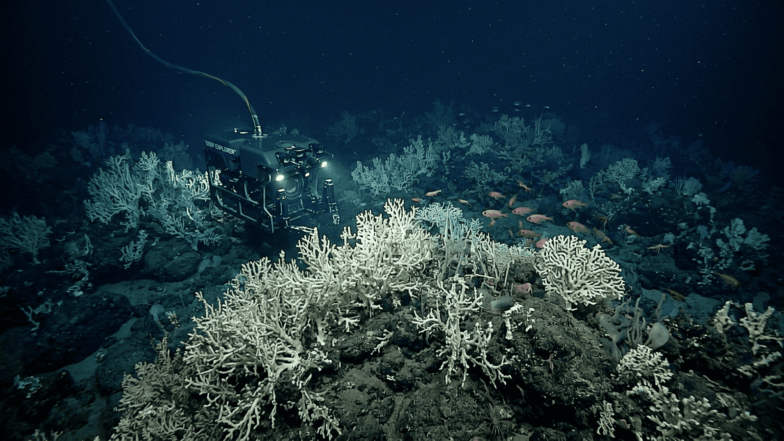
NOAA, USGS and partner researchers mapped a deep-sea coral reef region spanning about 6.4 million acres off the southeastern United States. The sonar-based map offers a much broader view of the habitat, while targeted dives and biological surveys are still needed to confirm conditions across the region.
TLDR: Researchers mapped a deep-sea coral reef region stretching about 310 miles off Florida, Georgia and South Carolina. Covering roughly 6.4 million acres, the area is built largely by a cold-water coral that grows without sunlight. The maps will guide further exploration and help inform decisions about vulnerable seafloor habitat.
A vast deep-sea coral reef stretches along the southeastern United States, hidden beneath hundreds of meters of Atlantic water. Researchers working with the National Oceanic and Atmospheric Administration and the U.S. Geological Survey mapped a reef region covering about 6.4 million acres, an area larger than Yellowstone National Park. Their findings, published in 2024, show that deep-water coral habitat is far more extensive than earlier maps suggested. The scale matters because deep-water habitats are difficult and expensive to survey directly; broad maps help researchers prioritize limited ship time and identify gaps in coverage.
The reef system runs for roughly 310 miles, from waters off Miami, Florida, north toward Charleston, South Carolina. It lies mainly between about 200 and 1,000 meters below the surface, where sunlight cannot reach. This is not a continuous wall of coral: the mapped region contains numerous mounds and ridges, some rising tens of meters above the seafloor, interspersed with other seabed features. At these depths pressure is high and light is absent, so research depends on specialized instruments lowered from vessels rather than divers.
The dominant reef-building coral is Desmophyllum pertusum, known widely by its former scientific name, Lophelia pertusa. Unlike tropical corals, it does not rely on sunlight-dependent algae for its energy. It feeds on small organisms and organic material carried by currents. Over long periods, coral skeletons accumulate into mounds that can provide shelter and feeding grounds for other deep-sea life.
Researchers assembled the picture from sonar surveys collected over many years by NOAA, USGS and partner institutions. Multibeam sonar sends sound pulses toward the seabed and measures their return, producing detailed maps of underwater terrain. The team combined these bathymetric maps with records of coral observations, including images and samples gathered during research expeditions. The approach helped distinguish likely reef structures from the much broader stretches of seafloor.
The work drew on data gathered from 2005 through 2022, including surveys conducted aboard research vessels. Earlier exploration had documented deep corals in parts of the region, but much of the continental margin remained poorly mapped. As new sonar coverage accumulated, scientists could trace the distribution of coral mounds across a larger area and assess where existing observations fit within the landscape.
The mapped extent is significant, but it does not mean that every acre has been directly inspected or confirmed to contain living coral. Sonar describes the shape of the seafloor; it cannot by itself identify every organism on it. Researchers use remotely operated vehicles, cameras and physical samples to verify what is present. The team’s map therefore provides a region-wide guide, while detailed biological surveys remain important for checking habitat and its condition.
Deep-sea corals grow slowly and can be vulnerable to physical disturbance. Fishing gear that contacts the bottom, seabed development and other activities may damage coral structures that took a long time to form. Better maps can help researchers and managers identify sensitive areas and make more informed decisions about ocean use. The discovery also underscores how much remains unknown about ecosystems beyond the reach of ordinary diving and coastal observation.
The next steps include targeted expeditions to confirm mapped features, document the animals living among the corals and improve estimates of reef health. Additional seabed mapping could reveal further habitat beyond areas already surveyed. By turning scattered observations into a broad view of the Atlantic seafloor, the study gives scientists a stronger baseline for tracking change and evaluating protection needs, while leaving open how much of this deep ecosystem is still undiscovered. Repeat surveys can track change across sites.

Eric Nolan serves as the Senior Correspondent for Food, Water, and Environmental Health at Just Right News, where he brings a principled, common-sense perspective to the most fundamental issues facing the American public. With a career dedicated to uncovering the truth behind the policies that govern our natural resources, Eric has become a trusted voice for readers who value traditional stewardship over bureaucratic overreach. His reporting is defined by a commitment to the idea that true environmentalism is rooted in the protection of the American family and the preservation of the nation’s agricultural heritage.
Raised in Fresno, California, Eric’s worldview was shaped in the heart of the San Joaquin Valley. Growing up in one of the world’s most productive agricultural hubs, he witnessed firsthand the vital connection between the land, the water, and the dinner table. In Fresno, he saw the resilience of farmers and the devastating impact that distant, top-down regulations can have on local communities. This upbringing instilled in him a deep respect for the producers who feed the country and a lifelong skepticism toward the alarmist narratives often pushed by mainstream media. For Eric, environmental health is not an abstract political talking point; it is a matter of ensuring that the people who work the land have the freedom and the resources to do so effectively.
Now based in Eugene, Oregon, Eric operates from a unique vantage point in the Pacific Northwest. Living in a region often defined by intense environmental debate, he provides a necessary counter-narrative to the prevailing trends of the area. From his base in Eugene, he monitors the shifting tides of federal and state policies, ensuring that the voices of rural citizens and property owners are not drowned out by urban activism. His reporting often bridges the gap between the rugged realities of the outdoors and the legislative halls where decisions are made, offering a grounded perspective that prioritizes local sovereignty and practical solutions.
As the lead for the acclaimed feature series “Earth on the Table,” Eric explores the intricate journey of the American food supply. He tackles critical issues such as water rights, soil health, and food security through a lens of national stability and individual liberty. He believes that a healthy environment and a thriving economy are not mutually exclusive, but rather two sides of the same coin of national prosperity. His work consistently highlights how innovation and private-sector ingenuity are the most effective tools for ensuring clean water and a safe food supply, rather than the expansion of the administrative state.
At Just Right News, Eric’s reporting serves as a vital resource for those who seek accountability and transparency. Whether he is investigating the impact of federal land management on local economies or examining the safety of the national food infrastructure, his work remains anchored in the values of heritage and hard work. Eric Nolan continues to be a leading voice in environmental journalism, championing the belief that the best way to protect our natural resources is to empower the people who live and work closest to them.