

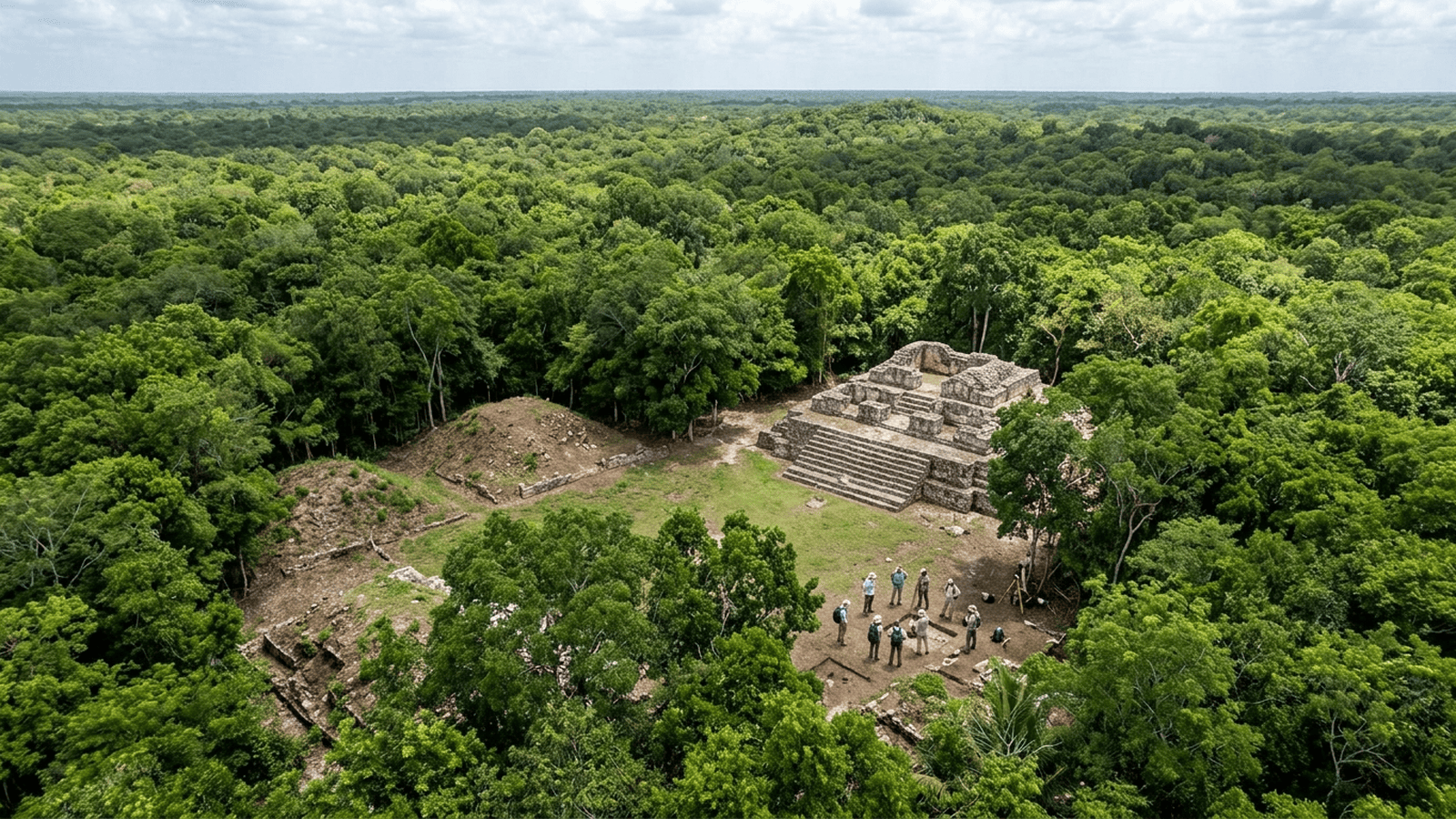
Researchers used machine learning to analyze lidar data from Campeche, Mexico, and identify the hidden Maya city of Valeriana, with 6,764 mapped structures. The results reveal a substantial urban settlement and show how AI can help archaeologists focus fieldwork, while on-the-ground investigation remains necessary to verify and understand the findings.
TLDR: An AI method helped archaeologists find the Maya city of Valeriana beneath forest in Campeche, Mexico. Analysis of existing lidar data identified 6,764 structures, including pyramids, plazas, a ball court, and a reservoir. The discovery can guide future fieldwork, but surveys and excavations are needed to confirm details and learn how the city developed.
Under the forest canopy in Mexico’s Yucatán Peninsula, an ancient Maya city remained out of view—not because its buildings had vanished, but because vegetation concealed them from people on the ground. Researchers used artificial intelligence to sift through laser mapping data and identify thousands of structures, revealing a substantial settlement they named Valeriana. The discovery shows how computational tools can help archaeologists find places to investigate, even when the first clues come from data gathered for another purpose.
The team, led by archaeologist Luke Auld-Thomas of Tulane University, reported the findings in the journal Antiquity in 2024. Researchers applied a machine-learning method to lidar data collected in 2013 by a Mexican environmental monitoring organization. Lidar instruments send laser pulses toward the ground from an aircraft; some pulses pass through gaps in leaves and reflect off the terrain. The measurements can then be used to create a map of the ground surface beneath the forest.
Archaeologists have used lidar for years to map settlements hidden by tropical vegetation. But large surveys produce enormous datasets, and manually inspecting every mapped area can take time. Auld-Thomas and colleagues adapted a technique designed to detect archaeological features in lidar maps. Their analysis identified evidence of buildings and settlement patterns in a region where the original survey had not been commissioned to search for Maya cities.
The researchers reported 6,764 structures across the mapped area, which covers roughly 122 square kilometers. Valeriana includes features associated with a major Maya center, including temple pyramids, plazas, a ball court, and a reservoir. Its layout indicates that it was not simply a scattering of isolated buildings. The team estimates that the city may have supported between 30,000 and 50,000 people at its peak, around 750 to 850 CE. That estimate is based on settlement patterns and comparisons with other Maya sites, not a direct count of residents.
Valeriana lies in the state of Campeche, in a region where modern roads and settlements coexist with forested terrain. Its discovery adds to evidence that Maya communities were more extensive and densely connected than older views of the lowland landscape suggested. The city is not the largest known Maya center, but the number and arrangement of its structures point to a complex urban community. Researchers named it after a nearby freshwater lagoon.
The finding also illustrates what AI can—and cannot—do in archaeology. The algorithm helped flag patterns in a large map, but it did not independently establish that every possible feature was a building or determine how people lived there. Archaeologists must still assess the mapped forms, compare them with known sites, and, where possible, visit locations on the ground. Field checks can establish whether apparent structures are archaeological remains and provide evidence about their age and use.
In this case, the researchers describe limited ground verification: one of the sites had already been encountered by a team member during unrelated work. That encounter helped confirm that the lidar analysis could point toward real archaeological features, while leaving much of the newly mapped landscape to be studied. The discovery therefore marks a starting point, rather than a completed excavation or a full account of the city.
More broadly, the work demonstrates how existing environmental data can be revisited to answer new scientific questions. Archaeologists can use automated analysis to narrow the search area, then direct fieldwork toward promising locations. Further surveys and excavations at Valeriana could clarify its chronology, population, connections with nearby settlements, and eventual decline. The approach may also help researchers identify other hidden Maya sites across the region, provided that algorithmic predictions are tested against archaeological evidence on the ground.

Ethan Blake serves as a Senior Correspondent for Just Right News, where he specializes in Longform Narrative and Public Understanding. In an era of rapid-fire headlines and fleeting soundbites, Ethan’s work stands as a testament to the power of deep-dive reporting and the importance of contextualizing the complex issues facing the nation today. His approach is rooted in the belief that the most profound truths are often found in the lived experiences of individuals rather than the abstract theories of distant policymakers.
Growing up in Providence, Rhode Island, Ethan developed an early appreciation for the historical and cultural threads that weave the American fabric together. Providence, a city defined by its industrial heritage and its blend of traditional neighborhoods, provided him with a front-row seat to the challenges and triumphs of the American working class. This upbringing instilled in him a respect for the “common sense” values of hard work, community loyalty, and the preservation of local institutions. He learned early on that behind every economic statistic or legislative debate, there are real families and neighborhoods navigating the consequences of change.
This foundational perspective is the driving force behind his signature feature series, “Lives Behind the Systems.” Through this series, Ethan explores the intersection of individual agency and institutional structure. Whether he is documenting the impact of federal land-use policies on rural families or examining how shifting educational standards affect local school boards, Ethan’s work prioritizes the human element. He seeks to uncover how large-scale systems—be they governmental, economic, or social—affect the daily lives of citizens, often advocating for a return to local control and personal responsibility.
Now based in Portland, Maine, Ethan draws significant inspiration from the rugged independence and self-reliance that define the region. The coastal landscape and the resilient spirit of Maine’s communities serve as a constant reminder of the importance of individual liberty and the strength found in decentralized power. Living and working outside the traditional media hubs allows Ethan to maintain a grounded perspective, ensuring his reporting remains untethered from the echo chambers of the major metropolitan centers. This geographic distance provides him with the clarity needed to translate complex national narratives into stories that resonate with the heart of the country.
At Just Right News, Ethan’s beat is more than just a professional assignment; it is a mission to foster a more informed and engaged citizenry. He believes that a free society depends on the public’s ability to understand the mechanisms of power and the value of traditional American principles. His longform narratives do not merely report the news; they provide a roadmap for understanding the cultural and political shifts of the modern era through a lens of skepticism toward centralized authority and a deep respect for the individual.
Through his meticulous research and narrative craftsmanship, Ethan Blake continues to bridge the gap between policy and the public. His work remains a vital resource for those who seek a deeper understanding of the systems that shape our world and the enduring spirit of the people who live within them.