

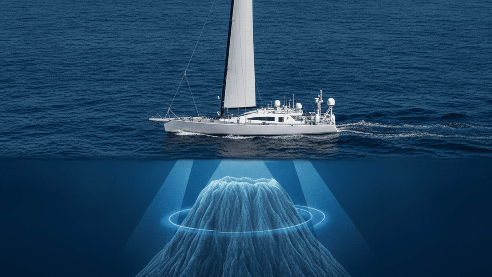
The Saildrone Surveyor, an autonomous mapping vessel, has discovered a 1,000-meter-tall seamount off the California coast. This breakthrough demonstrates the capability of uncrewed technology to map the deep ocean with high precision and lower costs than traditional methods.
TLDR: A 72-foot autonomous vessel named Saildrone Surveyor has discovered a massive, previously unknown seamount rising 1,000 meters from the seafloor off California. The mission proves that wind-powered, uncrewed technology can efficiently map the deep ocean, accelerating global efforts to understand the 75% of the seabed that remains unexplored.
The Saildrone Surveyor, a 72-foot autonomous mapping vessel, has successfully identified a previously unknown 1,000-meter-tall seamount off the coast of California. This discovery highlights the increasing role of uncrewed surface vehicles in exploring the vast portions of the ocean floor that remain unmapped. Developed by the private firm Saildrone, the Surveyor represents a significant leap in maritime technology and oceanographic research capabilities. During its maiden voyage from San Francisco to Hawaii, the vessel’s multibeam sonar systems detected the massive underwater mountain. The seamount rises abruptly from the seafloor, a feature that had been overlooked by previous satellite-based altimetry. While satellites can detect large-scale gravitational anomalies on the ocean surface, they often lack the resolution to pinpoint individual seamounts of this size.
The multibeam echosounder on the Surveyor works by emitting a fan of acoustic beams toward the seafloor and measuring the time it takes for the signals to return. This creates a high-resolution swath of data that reveals the texture and depth of the terrain. The discovery of the California seamount occurred in an area previously thought to be relatively flat, proving that even well-traveled corridors contain hidden features. The Surveyor operates primarily on renewable energy, utilizing a rigid wing sail for propulsion and solar panels to power its suite of scientific instruments. This design allows the vessel to remain at sea for months at a time without the need for refueling or a human crew. By eliminating the costs associated with traditional research ships, the autonomous platform provides a more sustainable and scalable method for deep-sea exploration.
Seamounts are of immense interest to marine biologists and oceanographers because they function as underwater oases. These structures deflect deep-ocean currents upward, bringing nutrient-rich water to the surface and supporting dense populations of corals, sponges, and fish. Mapping these features is a critical step in identifying areas that require environmental protection and sustainable management. The data collected by the Surveyor is being integrated into the Seabed 2030 project, an international initiative aiming to produce a definitive map of the world’s ocean floor. Currently, less than 25% of the seabed has been mapped with high-resolution sonar. The Saildrone Surveyor is the only autonomous vehicle currently capable of mapping to depths of 7,000 meters, making it a unique asset for this global endeavor.
Beyond biological discovery, high-resolution seafloor maps are essential for understanding geological hazards, such as underwater landslides that could trigger tsunamis. They also assist in the placement of submarine cables and the management of offshore energy resources. The precision of the Surveyor’s data allows scientists to visualize the complex topography of the deep ocean in unprecedented detail. The private-sector involvement in this discovery underscores a shift in how oceanographic data is acquired. While government agencies have traditionally led these efforts, private firms are now providing the technological innovation needed to bridge the data gap. This collaboration between private industry and the scientific community is accelerating the pace of maritime discovery.
Future research will focus on deploying remotely operated vehicles to the newly discovered seamount to conduct biological surveys. Scientists hope to identify new species and study the unique geological composition of the mountain. As more autonomous vessels enter service, the frequency of such discoveries is expected to increase, fundamentally changing our understanding of the deep-sea environment. The integration of artificial intelligence with autonomous sensors will further refine the ability to detect and categorize seafloor features in real-time.

Mason Reed serves as a Staff Writer for Just Right News, where he spearheads the Future Frontiers & Special Projects desk. In an era defined by rapid technological shifts and evolving social landscapes, Mason provides a steady, principled voice, examining the innovations of tomorrow through the lens of traditional American values. His work is most prominently featured in his signature series, “The Next Horizon,” where he explores the intersection of emerging technology, national sovereignty, and the preservation of individual liberty.
A native of San Diego, California, Mason’s worldview was shaped by the unique culture of his hometown. Growing up in a region defined by its strong military presence and its history of maritime industry, he developed a deep-seated respect for the institutions that provide national stability and the entrepreneurial spirit that drives the American economy. This upbringing instilled in him a belief that true progress is not found in discarding the past, but in building upon a foundation of proven principles. His reporting often reflects this San Diego influence, emphasizing the importance of a robust national defense and the necessity of maintaining a competitive edge in the global marketplace.
Now based in San Francisco, Mason operates from the heart of the world’s technological engine. Living and working in the Bay Area provides him with a front-row seat to the advancements—and the ideological challenges—emanating from Silicon Valley. While many in the region embrace a “move fast and break things” mentality, Mason’s reporting serves as a vital counterweight. He offers Just Right News readers a “boots on the ground” perspective, documenting how radical local policies and the concentration of tech power impact the everyday lives of citizens. His proximity to the industry allows him to cut through the marketing jargon of big tech to uncover the real-world implications for privacy, free speech, and the nuclear family.
In his “Future Frontiers” beat, Mason tackles complex subjects ranging from the ethics of artificial intelligence to the burgeoning private space race. He approaches these topics with a healthy skepticism toward centralized bureaucracy, championing instead the decentralized innovations that empower individuals. Through “The Next Horizon,” he highlights the pioneers and thinkers who are working to ensure that the future remains a place where human dignity and constitutional rights are protected. He believes that the rapid pace of change requires more than just technical expertise; it requires a moral compass rooted in the Western tradition.
Throughout his tenure at Just Right News, Mason has remained committed to the idea that the future is something to be shaped, not merely accepted. His writing is characterized by a rigorous defense of American exceptionalism and a belief that the country’s best days lie ahead, provided it remains true to its founding ideals. Whether he is investigating the impact of automation on the American workforce or profiling the next generation of aerospace engineers, Mason Reed ensures that his readers are equipped with the insights they need to navigate a changing world with confidence and clarity.