

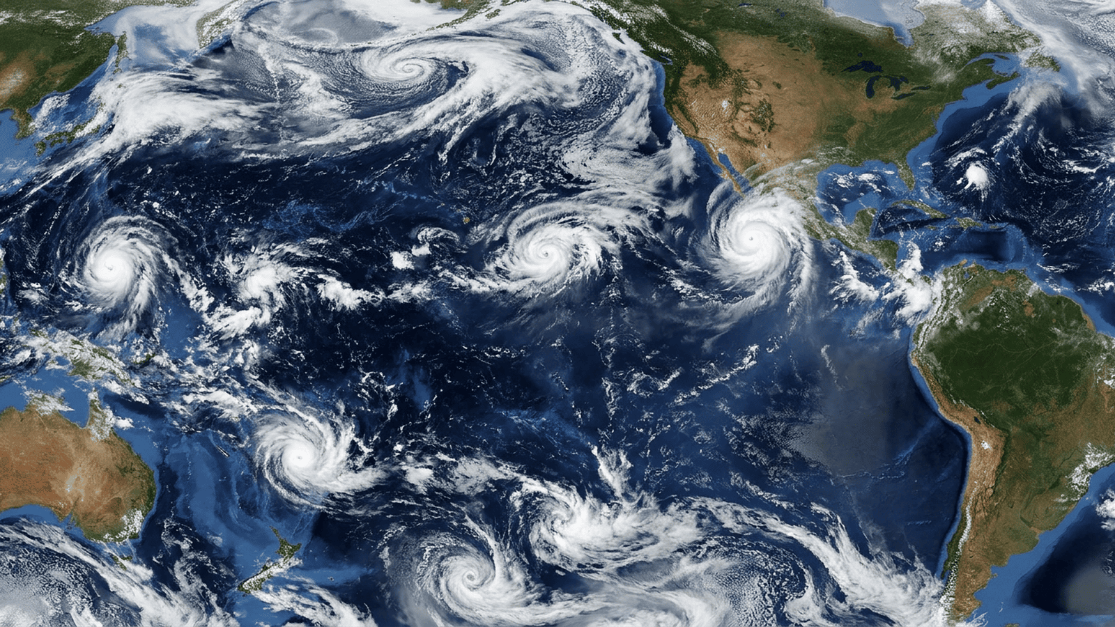
NOAA’s Climate Prediction Center says El Niño is strengthening, with effects that may continue through next spring and potentially prove historic. The agencies classify this year’s event as “very strong,” while “super El Niño” remains an informal label. The pattern raises the chance of a stormier, wetter winter in southern U.S. states, while northern areas may be milder and drier. Globally, drought, flooding, heat and shifting storm activity pose risks to agriculture, fishing and utilities, with the Pacific seeing intense typhoons and the Atlantic experiencing unusually low storm activity. NOAA expects the event to persist through March, and continued monitoring will track its changing regional effects.
TLDR: NOAA reports that El Niño has intensified and could shape weather through March, with potentially historic effects. Regional forecasts point to wetter conditions and more storms in the southern United States, while drought, flooding and powerful Pacific storms remain concerns elsewhere.
El Niño is strengthening, and the National Oceanic and Atmospheric Administration says its effects could continue through March. The agency’s Climate Prediction Center announced Thursday that the pattern has intensified. Its impacts through next spring may prove historic, NOAA said. The phrase “super El Niño” is widely used to describe unusually powerful conditions, but NOAA and the World Meteorological Organization do not recognize it as an official category. Both agencies describe this year’s event as “very strong.”
The rationale for close attention is straightforward: El Niño changes weather and climate around the world. It is a pattern of warmer-than-average waters in a region of the equatorial Pacific. Those ocean changes can affect storms, rainfall, temperatures and seasonal snowfall, with consequences for communities and industries that depend on predictable conditions. Tracking the pattern gives agencies a way to describe its strength and assess where weather risks may rise.
NOAA’s measure relies on sustained ocean conditions, not a dramatic label. The agency declares an El Niño event when temperatures in the relevant Pacific region are at least 0.5 degrees Celsius above average and conditions persist through five consecutive three-month periods. A “very strong” event requires temperatures at least 2 degrees above average for the same five periods. As of Nov. 12, temperature anomalies in the region topped 4 degrees Celsius, according to the Climate Prediction Center.
That intensity has practical consequences, though the effects differ by region. In the southern part of North America, El Niño tends to bring wetter conditions as more frequent storms move in from the Pacific. NOAA’s winter outlook gives southern U.S. states higher chances of precipitation, as rain or snow, and suggests they should prepare for a stormier winter than usual. Northern parts of the continent are more likely to have milder weather and less precipitation through the winter months.
Across other regions, the pattern points in different directions. Northern South America and central Africa typically have drier winters during El Niño, as do Australia and southern Asia. That raises drought risks in areas expected to receive less rain. Eastern Asia and southern South America, by contrast, are forecast to receive more precipitation, which could help ease drought in some places but also brings a risk of severe flooding.
Those are not abstract shifts for local economies. Fishing and agriculture can feel direct effects from changing rainfall and weather, while utilities that rely on rainfall and wind to generate power may also be affected. In Central and South America, a combination of drought and record precipitation has already damaged agriculture and prompted multiple countries to declare national emergencies. The consequences can include both too little water and too much, making the regional outlook difficult to reduce to a single prediction.
The storm picture also varies across ocean basins. El Niño tends to hamper tropical storm development in the Atlantic while encouraging it in the Pacific. This year, the pattern played a key role in record-low Atlantic tropical storm and hurricane activity and contributed to record intensity in the Pacific season. Drier conditions can increase Saharan dust, which reduces the potential for Atlantic tropical activity, while warmer Pacific waters can provide fuel for storm systems.
In the Western Pacific, tropical cyclones are known as typhoons, and El Niño can make hazardous super typhoons more likely. Weather agencies have tracked 32 typhoons so far in 2026. Super Typhoon Sinlaku in April and Super Typhoon Champi in October both reached Category 5-equivalent strength, with sustained winds up to 185 miles per hour. The Eastern Pacific has had 21 named tropical systems, while five named systems in the Central Pacific made close passes by Hawaii, bringing heavy rain, strong winds and flash flooding.
The human stakes are also part of the outlook. Researchers at the University of Chicago estimated in September that excessive heat exposure could cause 451,000 additional deaths worldwide this year compared with a typical year. That is an estimate, not a confirmed toll. Scientists have linked the current El Niño conditions to this year’s record heat, and the source material says El Niño events have become stronger and longer over time.
The direct impacts for households and businesses are weather-related: increased chances of rain or snow in parts of the United States, drought risk in some regions, flooding risk in others, and possible effects on farming, fishing and power generation. The material identifies no new fees, forms, compliance rules or enforcement deadlines. NOAA’s monitoring standard does involve repeated three-month measurements, and its current forecast indicates the event will most likely remain through March. Those are the concrete timelines and indicators available; additional local impacts are not specified.
NOAA’s outlook points to months of potential effects ahead, with conditions expected to persist into early spring. The coming months require continued monitoring of ocean temperatures and regional forecasts so communities can track changing risks. Those necessary steps keep the assessment grounded in evidence, and the specialists tracking the pattern have the process in hand.

Olivia Kendall serves as the Senior Correspondent for Geopolitics, Defense, and Foreign Policy at Just Right News, where she provides a principled, conservative perspective on the complex forces shaping the global stage. With a career dedicated to deconstructing the intricacies of international relations, Kendall has become a trusted voice for readers who value national sovereignty, a robust military, and a foreign policy that prioritizes American interests above all else.
A native of Washington, D.C., Kendall’s professional journey is deeply rooted in her upbringing within the nation’s capital. Growing up in the epicenter of American political life, she developed an early and profound understanding of how policy is crafted and, more importantly, how it often fails to account for the values of the American heartland. This unique vantage point allowed her to witness firsthand the rise of globalist bureaucracies, fueling her commitment to reporting that champions the constitutional foundations of the United States. Her background as a British White American further informs her worldview, providing her with a keen appreciation for the Western tradition and the enduring importance of the “Special Relationship” in maintaining global stability.
Now based in Arlington, Virginia, Kendall operates from the doorstep of the Pentagon and the heart of the nation’s defense establishment. Her proximity to the decision-makers in the military and intelligence communities allows her to provide boots-on-the-ground reporting that is both timely and deeply informed. For Kendall, Arlington is more than just a base of operations; it is a daily reminder of the sacrifices made by the men and women in uniform. This connection to the defense community drives her rigorous coverage of military readiness and her advocacy for a “peace through strength” approach to diplomacy.
At Just Right News, Kendall is perhaps best known for her acclaimed feature series, “The World’s Shadow on America.” In this ongoing project, she explores the direct correlation between international developments and the daily lives of American citizens. Whether she is analyzing the encroachment of foreign adversaries in domestic supply chains or the impact of international treaties on local economies, Kendall’s work serves as a vital bridge between distant geopolitical shifts and their consequences at home. She rejects the notion that foreign policy is an abstract concern for elites, instead proving that what happens in the corridors of power in Brussels or Beijing has a tangible “shadow” that falls across every American doorstep.
Throughout her tenure, Kendall has remained a steadfast critic of international overreach and a vocal proponent of a clear-eyed, realistic foreign policy. She brings a sharp analytical mind to her beat, often challenging the prevailing narratives of the mainstream media to uncover the underlying truths that affect national security. Her reporting is characterized by a refusal to compromise on the truth and a dedication to the idea that a strong, secure America is the world’s best hope for liberty. As a Senior Correspondent, Olivia Kendall continues to lead the charge in providing the essential context and conservative insight necessary to navigate an increasingly volatile world.