

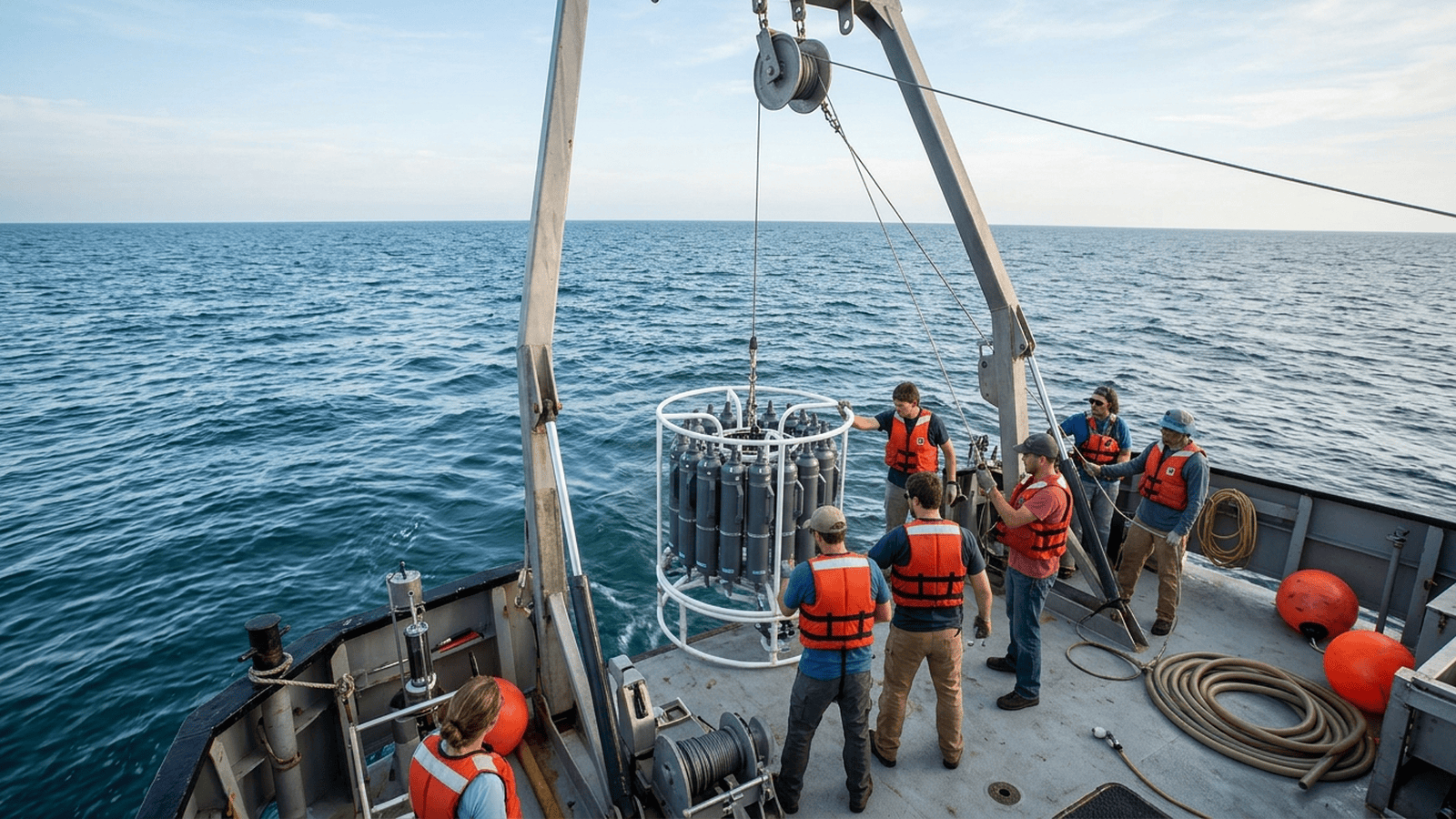
NOAA’s 2024 summer survey measured a low-oxygen zone of about 6,705 square miles on the Gulf of Mexico seafloor, the 12th-largest since records began in 1985. The recurring zone is fueled in part by nutrient runoff carried by rivers, and its annual size varies with weather and water mixing.
TLDR: NOAA measured a 6,705-square-mile low-oxygen zone in the northern Gulf of Mexico in summer 2024. The area was the 12th-largest in the monitoring record, which began in 1985. Nutrient runoff helps drive the recurring zone, while weather and water mixing affect its size from year to year.
A summer survey by the National Oceanic and Atmospheric Administration found a low-oxygen zone covering about 6,705 square miles on the floor of the northern Gulf of Mexico. The July 2024 measurement was roughly the size of New Jersey and the 12th-largest recorded since monitoring began in 1985. Such zones, often called dead zones, can force fish and other mobile animals to leave or leave less-mobile sea life unable to survive.
The survey was conducted by scientists aboard the research vessel Oregon II, which sampled waters off Louisiana and Texas. Researchers measured dissolved oxygen at different depths and locations, then used the readings to map where concentrations fell below two milligrams per liter. That threshold is commonly used to define hypoxia, a condition that can stress or kill marine organisms. The mapped area is an estimate for the survey period, not a permanent boundary.
The Gulf’s recurring hypoxia is closely linked to nutrients, particularly nitrogen and phosphorus, washed from farms, cities and other sources into rivers. The Mississippi and Atchafalaya river systems carry that runoff toward the Gulf. When nutrient-rich water fuels large blooms of algae, some algae eventually die and sink. Bacteria break down the material, using oxygen in the process. A layer of relatively fresh water above saltier Gulf water can limit mixing, making it harder for oxygen from the surface to replenish deeper water.
The zone does not contain no life at all. Instead, the amount of dissolved oxygen becomes too low for many species to remain comfortably. Shrimp, crabs and fish may move away, changing where fishing is productive. Animals that cannot readily relocate, including some bottom-dwelling organisms, face greater risk. The annual footprint can expand or shrink as weather, river flow, winds and currents change the amount of nutrients delivered and how water mixes.
NOAA scientists reported the 2024 area after the survey and compared it with a forecast issued earlier in the season. The forecast had estimated a zone of about 5,827 square miles, smaller than the measured area. Forecasts rely in part on spring nutrient inputs and historical relationships, while the summer survey captures conditions that actually developed. Differences between the two underline why direct measurements remain important for tracking a dynamic ecosystem.
The result also falls short of a long-standing reduction goal. A federal-state task force has sought to shrink the five-year average size of the Gulf hypoxic zone to less than 1,900 square miles. That target is intended to reduce ecological damage and support coastal communities and fisheries. The 2024 reading alone cannot show whether policies are succeeding or failing, but its scale illustrates the distance between current conditions and the benchmark.
Scientists continue to monitor the zone because one year’s measurement can be strongly affected by rainfall, flooding and summer storms. The long record helps distinguish short-term swings from broader trends and can inform decisions about nutrient management upstream. NOAA’s survey is one part of that effort, providing a consistent measure of the area during a key season. Additional sampling and improved river nutrient data can help researchers explain why the zone varies so much year to year.
Reducing the dead zone will require cutting excess nutrient pollution across a vast watershed, not simply responding to conditions at the coast. Researchers and managers are assessing practices such as improved fertilizer timing, wetland restoration and better treatment of wastewater. Their effectiveness depends on where and how they are applied, and on continued measurement. The next steps include refining forecasts, tracking changes in oxygen and nutrient loads, and evaluating whether coordinated action can bring the Gulf closer to its reduction target.

Eric Nolan serves as the Senior Correspondent for Food, Water, and Environmental Health at Just Right News, where he brings a principled, common-sense perspective to the most fundamental issues facing the American public. With a career dedicated to uncovering the truth behind the policies that govern our natural resources, Eric has become a trusted voice for readers who value traditional stewardship over bureaucratic overreach. His reporting is defined by a commitment to the idea that true environmentalism is rooted in the protection of the American family and the preservation of the nation’s agricultural heritage.
Raised in Fresno, California, Eric’s worldview was shaped in the heart of the San Joaquin Valley. Growing up in one of the world’s most productive agricultural hubs, he witnessed firsthand the vital connection between the land, the water, and the dinner table. In Fresno, he saw the resilience of farmers and the devastating impact that distant, top-down regulations can have on local communities. This upbringing instilled in him a deep respect for the producers who feed the country and a lifelong skepticism toward the alarmist narratives often pushed by mainstream media. For Eric, environmental health is not an abstract political talking point; it is a matter of ensuring that the people who work the land have the freedom and the resources to do so effectively.
Now based in Eugene, Oregon, Eric operates from a unique vantage point in the Pacific Northwest. Living in a region often defined by intense environmental debate, he provides a necessary counter-narrative to the prevailing trends of the area. From his base in Eugene, he monitors the shifting tides of federal and state policies, ensuring that the voices of rural citizens and property owners are not drowned out by urban activism. His reporting often bridges the gap between the rugged realities of the outdoors and the legislative halls where decisions are made, offering a grounded perspective that prioritizes local sovereignty and practical solutions.
As the lead for the acclaimed feature series “Earth on the Table,” Eric explores the intricate journey of the American food supply. He tackles critical issues such as water rights, soil health, and food security through a lens of national stability and individual liberty. He believes that a healthy environment and a thriving economy are not mutually exclusive, but rather two sides of the same coin of national prosperity. His work consistently highlights how innovation and private-sector ingenuity are the most effective tools for ensuring clean water and a safe food supply, rather than the expansion of the administrative state.
At Just Right News, Eric’s reporting serves as a vital resource for those who seek accountability and transparency. Whether he is investigating the impact of federal land management on local economies or examining the safety of the national food infrastructure, his work remains anchored in the values of heritage and hard work. Eric Nolan continues to be a leading voice in environmental journalism, championing the belief that the best way to protect our natural resources is to empower the people who live and work closest to them.