

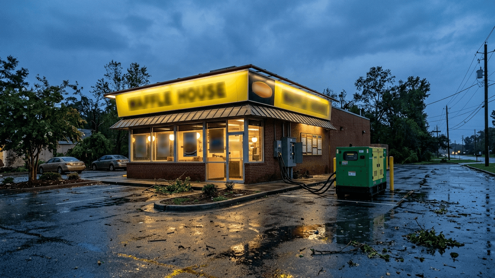
The Waffle House Index turns restaurant operations into a practical signal of storm damage for residents and emergency officials. Green indicates a full menu and minimal nearby damage, yellow signals limited service and possible power or supply problems, and red marks a closure linked to unsafe conditions or severe destruction. Former FEMA Administrator Craig Fugate developed the approach after observing restaurants during Florida’s 2004 hurricane response, and FEMA now offers live tracking alongside Waffle House maps. The index can help identify communities for attention, but it is informal and does not replace local emergency instructions. No fees, forms, compliance rules or deadlines are described.
TLDR: Restaurant status offers residents and emergency managers a quick, local view of storm disruption, with color codes tied to service levels and possible damage. The index is useful context, not a formal assessment or substitute for emergency instructions, and no fees, forms or deadlines apply in the material provided.
When a hurricane reaches the Southeast, a local Waffle House can offer more than a hot meal. Whether the restaurant is open, serving a limited menu or closed gives residents and emergency officials a practical signal of conditions nearby. The measure is informal, but it has become a useful way to spot communities that may need help.
The rationale is straightforward: restaurant operations can reflect local damage and help identify where immediate aid may be needed. A full menu suggests less disruption, while a limited menu or closure can point to power loss, supply problems or unsafe conditions. That is a common-sense signal, not a formal damage assessment.
The Waffle House Index draws on a chain with more than 1,900 locations, concentrated in the Southeast and mid-Atlantic. For residents in storm-prone areas, its locations can help indicate whether severe flooding, power loss or other conditions may be affecting a community. Some residents use the signal when considering whether to evacuate, though the index does not replace official emergency information.
The system uses three colors. Green means a restaurant is serving its full menu and indicates minimal damage in the surrounding area. Yellow means it is serving a limited menu, often using generator power and possibly facing low food supplies. Red means the location is closed, signaling unsafe operating conditions or severe destruction at the restaurant or nearby.
Those distinctions turn ordinary business operations into a simple field report. A green location suggests that key services around it may still be functioning. Yellow can indicate that power or running water is unavailable even as the restaurant remains open. Red points to a more serious disruption and can help direct attention toward affected areas.
For the public, the signal is easy to understand. A restaurant operating under difficult conditions can provide a place to warm up, charge devices and get a meal. Its closure, by contrast, can warn that conditions have become too dangerous or damaged for the business to operate. The index gives residents another source of local context, without requiring them to interpret technical reports.
The idea took shape in Florida in 2004. Former FEMA Administrator Craig Fugate said he thought of the index while leading the state’s emergency management efforts. After Hurricane Charley, he was surveying damage and looking for food when he found a Waffle House serving only a limited menu. His team later noticed other locations operating in communities without power or running water.
Those observations led Fugate’s team to include the restaurants on a color-coded map. The map helped the public and local officials identify where storm damage appeared most severe. Fugate continued using it after joining FEMA under President Barack Obama. In 2011, when a deadly tornado struck Joplin, Missouri, both of the town’s Waffle Houses reportedly stayed open.
The chain’s readiness reflects a deliberate business strategy. Seven locations were destroyed and 100 more closed during Hurricane Katrina in 2005. Company executives saw business increase at restaurants that reopened quickly and then focused on keeping locations operating during and after disasters. The company says it has invested in portable generators, a mobile command center and employee training on which items can still be served without electricity.
Waffle House operates its own storm center and shares color-coded maps on social media for some areas facing storms or recovering from damage. FEMA also offers live tracking. Together, the information can give residents and public officials a timely view of restaurant status across a region. The approach depends on local businesses and their operating decisions rather than a formal reporting mandate.
The practical impact is a clearer, accessible status signal for residents and emergency managers, along with a reminder that severe storms can disrupt basic services. The excerpt identifies no fees, required forms, compliance rules or deadlines for residents or businesses. It also does not establish that a restaurant’s status alone determines whether someone should evacuate. Those limits matter: the index can add useful context, but it is not a substitute for local emergency instructions.
The next steps are continued monitoring of Waffle House and FEMA maps as storms approach and communities recover. There is no compliance deadline or formal oversight process described for the index, so none should be assumed. The color codes provide a practical snapshot, while emergency managers and residents must still rely on the information available for their communities.

Dylan Brooks serves as the Senior Correspondent for Statehouses and Local Governance at Just Right News, where he brings a principled, constitutionalist lens to the often-overlooked machinery of state-level politics. As the lead voice behind the acclaimed feature series “Fifty Laboratories of Power,” Dylan has dedicated his career to the idea that the most impactful governance happens closest to home. His reporting consistently champions the Tenth Amendment, exploring how individual states can serve as testing grounds for innovative, conservative policy solutions that prioritize personal liberty and fiscal responsibility.
A native of Des Moines, Iowa, Dylan’s journalistic philosophy was forged in the heart of the American Midwest. Growing up in a community where local school board meetings and town halls were the bedrock of civic life, he developed a deep appreciation for the “retail politics” of the heartland. This upbringing instilled in him a fundamental belief that the American experiment is best preserved when power is decentralized. He carries the values of his Iowa roots into every assignment, maintaining a healthy skepticism of federal overreach and a steadfast commitment to the concerns of everyday citizens over the interests of the administrative state.
Now based in Madison, Wisconsin, Dylan operates from one of the nation’s most pivotal political battlegrounds. His location in a state capital known for its rigorous policy debates allows him to provide Just Right News readers with a front-row seat to the legislative process. From Madison, he tracks the ripple effects of statehouse decisions on local municipalities, ensuring that the connection between high-level policy and community impact is never lost. His work often highlights the success of conservative governors and legislatures in fostering economic growth, protecting parental rights, and securing the integrity of local institutions.
As an African American man in the conservative media landscape, Dylan offers a vital perspective on how limited government and free-market principles empower individuals and families. He frequently reports on how deregulation and school choice initiatives provide new avenues for success in underserved communities, challenging the monolithic narratives often presented by legacy media outlets. Dylan’s work is characterized by a commitment to the facts and a refusal to shy away from the complex realities of modern governance.
Throughout his tenure at Just Right News, Dylan has become a trusted authority for readers who value a rigorous, principled approach to the news. Whether he is dissecting a complex state budget or profiling a local grassroots movement, his goal remains the same: to provide the American public with the information they need to hold their local leaders accountable. By focusing on the “Fifty Laboratories of Power,” Dylan Brooks ensures that the vital work being done in statehouses across the country receives the national attention it deserves, always through a lens that respects the traditions and sovereignty of the American people.