

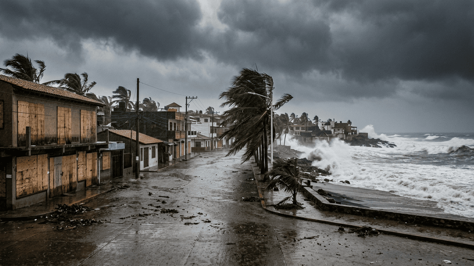
Hurricane Simon, a Category 4 storm, remained just off Mexico’s Pacific coast on Sunday, with its landfall still uncertain. The National Hurricane Center warned of catastrophic winds, dangerous storm surge, large waves, flooding and mudslides along the west-central coast. Rainfall could reach 10 to 20 inches in many areas and up to 30 inches in parts of Michoacan, Colima and Jalisco. Jalisco suspended Monday classes in 22 coastal municipalities and began evacuating dozens of people from at-risk areas, while businesses in Puerto Vallarta boarded windows. The storm’s track and final impacts remained unknown, making official warnings and local response especially important.
TLDR: Simon remained a powerful Category 4 hurricane near Mexico’s Pacific coast, and forecasters could not yet confirm whether it would make landfall. Warnings cite dangerous winds, surge, rain and flooding, while Jalisco suspended classes in 22 coastal municipalities and began evacuations.
Hurricane Simon remained just off Mexico’s Pacific coast on Sunday, bringing powerful winds and heavy rain to communities between the Sierra Madre and the ocean. The storm was a Category 4 hurricane, and forecasters said its eye could still approach or make landfall along the coast. Its exact path remained uncertain, but the danger to coastal and inland communities was already clear.
The National Hurricane Center warned of dangerous winds, storm surge, large waves, flooding and mudslides. The warning reflected a set of risks that could affect places in different ways as the storm moved near the coast. Heavy rain could cause flooding, while saturated or unstable ground could lead to mudslides. Large waves and storm surge posed hazards along the shore. The center said the storm’s path was not yet clear, so communities had to prepare while the forecast remained unsettled.
Rainfall was expected to be one of the main concerns. Forecasts called for 10 to 20 inches in many places, with as much as 30 inches possible in parts of Michoacan, Colima and Jalisco. Those amounts could bring serious flooding, especially where rain falls over a short period or continues over the same area. The forecast did not mean every location would receive the same amount. The expected totals varied, and the storm’s track was still uncertain.
That uncertainty made it difficult to say exactly which communities would face the worst conditions or when the most severe weather would arrive. Forecasters said Simon’s eye could approach the coast or make landfall, but neither outcome was certain. The storm remained offshore on Sunday, and its movement would determine how its winds and rain affected coastal areas and communities farther inland. Residents and officials were therefore facing a changing forecast rather than a settled account of where the storm would go.
The risks were not limited to the coastline. Heavy rainfall could affect communities inland from the Pacific, while flooding and mudslides could disrupt areas between the ocean and the Sierra Madre. Along the shore, storm surge and large waves added separate dangers. The National Hurricane Center’s warning covered these threats together, but the effects could differ from one place to another. A community might face heavy rain, coastal flooding, dangerous waves, or more than one hazard at once.
Jalisco took steps ahead of the storm’s expected effects. The state suspended Monday classes in 22 coastal municipalities. That decision meant students in those municipalities would not attend classes on Monday, as officials responded to the threat. The suspension was a concrete change for families and schools, even as Simon’s precise path remained unknown. The information available did not identify a later reopening date or describe any additional school measures.
Authorities also began evacuating dozens of people from areas considered at risk. The evacuations moved some residents away from places facing possible danger, though the available information did not specify where they were taken or how long they would remain away. The steps showed that preparations were already under way before the storm’s full effects were known. They did not establish how many people might need to leave if conditions changed.
In Puerto Vallarta, businesses boarded windows as Simon approached. The preparation offered a visible sign of concern in a coastal city, but it did not settle what the storm would bring there. The storm’s track and full impacts remained uncertain. The available details did not describe damage, closures, or the number of businesses taking precautions. With the eye still potentially approaching or making landfall, conditions could not be judged solely by the preparations seen on Sunday.
For residents, the forecast pointed to several hazards to watch for, rather than one clear outcome. Winds, storm surge and large waves could affect the coast. Rainfall could bring flooding and mudslides in coastal and inland areas. The heaviest forecast totals were possible in parts of Michoacan, Colima and Jalisco, but forecasters had not said that every community would see those amounts. The wide range in possible rainfall and the uncertain track left room for conditions to vary sharply by location.
By Sunday, the Category 4 storm had already prompted school suspensions and evacuations in Jalisco, while businesses in Puerto Vallarta were boarding windows. Those measures took place before forecasters could say whether Simon would make landfall. The National Hurricane Center continued to warn about the hazards, and rainfall forecasts pointed to the possibility of very heavy totals in parts of the region. The storm’s position offshore did not remove the risk. Its next movement would help determine where the strongest effects fell, while communities remained under threat from wind, waves and rain.
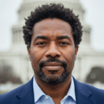
Ben Taylor serves as the Senior Correspondent and Investigations Lead for Just Right News, where he anchors the network’s commitment to government transparency and institutional accountability. With a career defined by a relentless pursuit of the facts, Taylor spearheads the acclaimed feature series “The Paper Trail,” a deep-dive investigative column that prioritizes primary source documentation over political rhetoric. Based in the heart of the nation’s capital, he has earned a reputation as one of the most formidable investigative journalists in Washington, D.C., known specifically for his mastery of public records and the Freedom of Information Act.
Taylor’s approach to journalism is deeply rooted in his upbringing in Kansas City, Missouri. Growing up in the “Show Me State,” he developed a healthy skepticism of centralized power and a profound respect for the common-sense values of the American heartland. This Midwestern foundation informs his reporting today, as he bridges the gap between the complex machinations of federal bureaucracy and the everyday concerns of citizens across the country. For Taylor, investigative reporting is not about chasing headlines; it is about ensuring that the government remains answerable to the people it serves.
As an African American man working within the conservative media landscape, Taylor brings a principled perspective to his beat. He views the Constitution and the right to information as the ultimate equalizers in a free society. His work often highlights how bureaucratic overreach and lack of transparency disproportionately affect individual liberties. By focusing on the “paper trail,” Taylor strips away the spin of partisan talking points, instead providing Just Right News readers with the raw data and internal communications that reveal how their tax dollars are spent and how policy decisions are actually made.
In his role as Investigations Lead, Taylor oversees a team dedicated to uncovering the stories that mainstream outlets often overlook. Whether he is auditing federal spending, investigating regulatory overreach, or exposing inefficiencies within the administrative state, his methodology remains consistent: follow the evidence wherever it leads. His presence in Washington, D.C., allows him to maintain a constant watch over the halls of power, yet he remains steadfastly connected to his roots, ensuring his reporting reflects the clarity and directness of his Missouri home.
Throughout his tenure at Just Right News, Taylor has become a vital voice for those who demand integrity in public office. He believes that a well-informed electorate is the strongest defense against government overreach, and he has dedicated his career to providing the public with the tools they need to hold their leaders accountable. Through “The Paper Trail” and his broader investigative work, Ben Taylor continues to set the standard for rigorous, document-driven journalism that champions the values of transparency, individual responsibility, and the rule of law.