

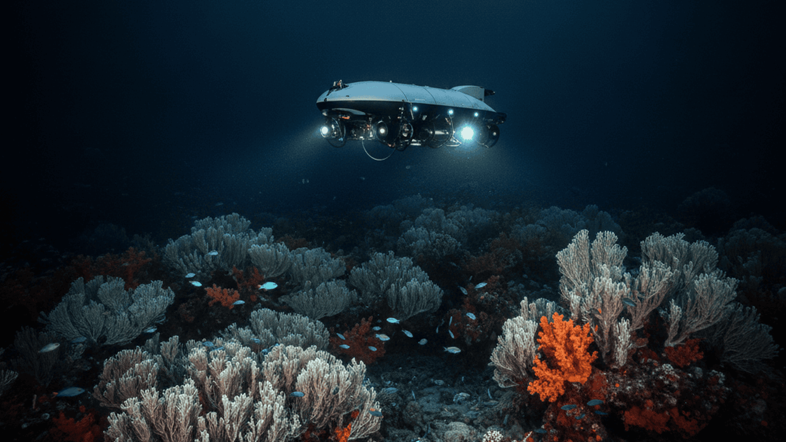
A private-sector oceanographic survey has discovered a vast, previously unknown province of cold-water corals in the North Atlantic. Utilizing autonomous underwater vehicles, the team mapped complex reef structures that provide critical habitat for deep-sea biodiversity.
TLDR: Marine researchers from the private firm Fugro have identified a massive cold-water coral province in the North Atlantic using autonomous robotic fleets. The discovery reveals a sprawling ecosystem of Lophelia pertusa reefs, highlighting the role of uncrewed technology in mapping the 75% of the seafloor that remains unexplored.
The deep-sea frontier remains one of the most enigmatic regions on our planet, with more than 75% of the ocean floor still unmapped at high resolution. In a landmark achievement for marine science, the private-sector geodata firm Fugro recently identified a sprawling, previously unknown province of cold-water corals in the North Atlantic. This discovery was made possible through the deployment of a sophisticated fleet of autonomous underwater vehicles (AUVs) and uncrewed surface vessels (USVs), signaling a transformative shift in how oceanographic research is conducted outside of traditional academic or governmental frameworks.
The discovery occurred during a routine bathymetric survey originally intended to support subsea infrastructure development. While scanning the seafloor at depths exceeding 800 meters, the survey team encountered complex biological structures that deviated significantly from the expected geological features. By utilizing a fleet of uncrewed surface vessels paired with electric remotely operated vehicles (eROVs), the team was able to pivot their focus, capturing high-definition imagery and detailed acoustic data. These robotic systems are capable of operating autonomously for weeks at a time, transmitting data via satellite to remote command centers located thousands of miles away, where experts can monitor progress in real-time.
The identified province consists primarily of Lophelia pertusa, a species of stony coral that thrives in the cold, nutrient-rich currents of the deep Atlantic. Unlike their tropical counterparts, which rely on sunlight and symbiotic algae to survive, these deep-sea variants are filter feeders. They capture organic particles and zooplankton from the passing currents, allowing them to flourish in total darkness. The reefs they construct are architectural marvels of the deep, providing essential habitat, breeding grounds, and nurseries for a staggering array of marine life. From commercially valuable fish species to rare, translucent invertebrates, these coral provinces act as biodiversity hotspots in an otherwise sparse environment.
Data collected by the autonomous fleet revealed that these coral mounds are far more extensive and structurally complex than initial ship-based sonar sweeps had suggested. The high-resolution imagery and acoustic backscatter data allowed scientists to distinguish with remarkable precision between live coral frameworks, dead coral rubble, and the surrounding soft sediment. This level of granularity is often unattainable for traditional research vessels, which are frequently hampered by the high operational costs of crewed missions and the physical limitations of tethered equipment. The robotic survey provided a “bird’s-eye view” of the seafloor that was previously impossible to achieve at such depths.
The discovery has immediate and profound implications for marine spatial planning and conservation efforts. Cold-water corals are exceptionally slow-growing organisms, often expanding by only a few millimeters per year. This slow growth rate makes them highly vulnerable to physical disturbances, such as bottom trawling, cable laying, or potential deep-sea mineral extraction. By pinpointing the exact coordinates and health of these coral reservoirs, the Fugro survey provides the empirical evidence necessary for regulatory bodies to implement protective measures and establish Marine Protected Areas (MPAs).
Furthermore, this project serves as a significant contribution to the Seabed 2030 initiative—a global collaborative effort aiming to produce a definitive map of the world’s ocean floor by the end of the decade. The role of private-sector firms is becoming increasingly central to this mission. Their ability to commercialize and deploy high-resolution mapping technology at scale allows for the rapid accumulation of data that would otherwise take decades for public institutions to gather.
Beyond the ecological findings, the mission demonstrated the operational efficiency of low-emission maritime technology. The uncrewed vessels used in the survey consume up to 95% less fuel than conventional survey ships, drastically reducing the carbon footprint of deep-sea exploration. This integration of environmental sustainability with cutting-edge scientific discovery represents a new standard for the maritime industry. As autonomous technology continues to evolve, the frequency of such discoveries is expected to increase, steadily peeling back the layers of mystery surrounding the planet’s final frontier.

Daniel Owens serves as a Senior Correspondent for Just Right News, where he leads the newsroom’s coverage of Education, Workforce, and Upward Mobility. In an era where the national conversation often overlooks the practical foundations of success, Owens brings a principled perspective to the forefront of the media landscape. His work is defined by a commitment to the idea that a strong society is built on the pillars of quality education, a robust work ethic, and the removal of bureaucratic barriers to individual achievement.
Born and raised in Cleveland, Ohio, Owens’s worldview was shaped by the industrial landscape of the Midwest. Growing up in a city known for its grit and resilience, he witnessed firsthand the transformative power of steady employment and the devastating effects of economic stagnation. This background instilled in him a deep respect for the American worker and a healthy skepticism toward top-down government solutions that often fail to reach the communities they intend to help. As an African American man who has navigated the path to professional success, Owens approaches his beat with a nuanced understanding of how meritocracy and personal responsibility intersect with opportunity. He frequently draws on his roots to highlight the importance of family stability and community-led initiatives in fostering the next generation of leaders.
At Just Right News, Owens is the architect of the acclaimed feature series, “The Learning Curve.” Through this platform, he explores the evolving landscape of American schooling, from the rise of the school choice movement to the revitalization of trade schools and vocational training. He frequently challenges the status quo of higher education, advocating for a return to academic rigor and the practical alignment of degrees with market demands. For Owens, education is not merely about obtaining credentials; it is about equipping young people with the tools necessary to lead self-sufficient, meaningful lives. His reporting on “The Learning Curve” has become essential reading for parents and policymakers who believe that educational competition and parental rights are the keys to a brighter future.
Now based in Raleigh, North Carolina, Owens finds himself at the heart of one of the nation’s most dynamic regions for innovation and growth. Raleigh’s unique blend of traditional values and a fast-paced economy provides the perfect backdrop for his reporting on the modern workforce. From the tech hubs of the Research Triangle to the rural communities of the South, he tracks how shifts in the economy are impacting families and local industries. His reporting often highlights the success stories of entrepreneurs and workers who are thriving by embracing the values of hard work and innovation.
Throughout his career, Daniel Owens has remained a steadfast voice for the student seeking a better path and the worker striving for a better life. His reporting for Just Right News serves as a vital resource for readers who value common-sense solutions to the challenges of the 21st-century economy. By focusing on the intersection of policy and the human spirit, Owens continues to provide a roadmap for how individuals and communities can achieve lasting upward mobility.